
Nature reserve: שמורת טבע נחל אוג
Keep to the reserve rules and stay on the marked trails.
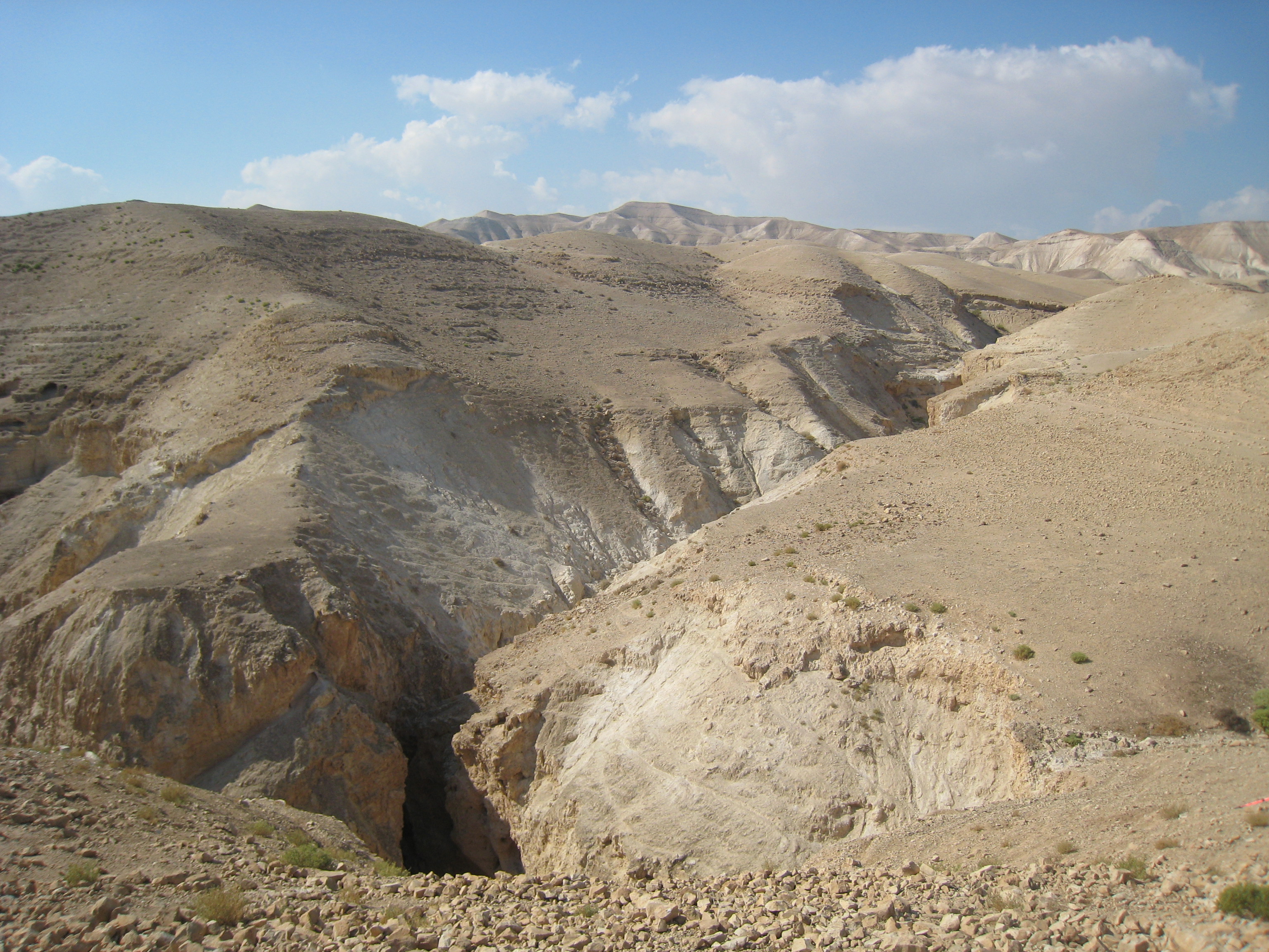
The canyon section of Nahal Og near Kibbutz Almog, a short, dry family route where dry falls are passed with iron ladders and handholds.
Also known as: Wadi Og
- Good for beginners
- Dead Sea
- Easy access
- Families
- Waterfalls
Information as of 21 Oct 2026
At a glance
- Duration
- 3 h
- Trail length
- 4 km
- Tallest waterfall
- 10 m
- Rope needed
- 30 m
- Water
- Dry
- Reserve:
- שמורת טבע נחל אוג
Field reports
How much water there was and how it went, from people who were here. Every report is reviewed before it is published.
No reports from this place yet
Were you here lately? Tell us how much water there was and how it went. It helps the next group plan.
Meeting point (parking)
חניון ליד הכניסה לקיבוץ אלמוג, צפון ים המלח
The meeting point is the parking spot. You continue on foot from here.
Coordinates: 31.78670, 35.45760
About
Nahal Og runs from east of Jerusalem down to the northern Dead Sea. In its lower section, near Kibbutz Almog, it has cut a short canyon in hard limestone, with dry falls fitted with iron ladders and handholds.
It is an easy, marked route in an open Israel Nature and Parks Authority reserve with no entry fee. There are no planned rappels: the falls are passed on ladders. It suits families and groups of beginners, with views over the Dead Sea and the Judean Desert.
Getting there
נוסעים מירושלים לים המלח (כביש 1). בצומת אלמוג פונים דרומה (ימינה). אחרי שני ק"מ מגיעים לכיכר. נוסעים ישר ומגיעים לרחבת חניה גדולה, כ-100 מ' אחרי שער הכניסה לקיבוץ. דרך סלולה, פונה דרומה מכביש 1 לנבי מוסא, נמשכת דרומה וחוצה את נחל אוג כ-3 ק"מ מנבי מוסא. דרך עפר, מתאימה לרכבי 4X4. פונה דרומה מכביש 1 כ-2.5 ק"מ ממזרח לכניסה למצפה יריחו (סימון ירוק). דרך עפר אחרת לרכבי 4X4 יוצאת בשביל מסומן כחול מצומת מצפה יריחו מערבה. הדרך חוצה את מעביר המים לכיוון נחל אוג. תחילת המסלול מגשר נביא מוסא לכיוון מזרח - שביל מסומן בצבע ירוק והופך לכחול בנחל אוג תחתון. סיום בקיבוץ אלמוג.
Access notes
From Route 1 turn south at Almog junction, go straight at the roundabout and reach a large parking area just past the kibbutz gate. The route starts at the Nabi Musa bridge heading east, on a green trail that turns blue in lower Nahal Og, and ends at Almog. There are also dirt roads for 4x4s from Route 1 and from Mitzpe Yericho.
Parking
A large free parking area at the entrance to Kibbutz Almog. There is also a viewpoint at the Nahal Og parking, south of Almog junction.
Difficulty and suitability
- Difficulty
- Easy
- Good for beginners
- Yes
- Minimum age
- From age 6
- Recommended group size
- Up to 30 people
- Typical duration
- 3 h
- Hiking distance
- 4 km
- Elevation gain
- 107 m
- Water activity
- No
- Route type
- Dry
Waterfalls
| Measure | Value |
|---|---|
| Tallest waterfall | 10 m |
Seasons
Points on the map
- Meeting pointPrimaryחניון ליד הכניסה לקיבוץ אלמוג, צפון ים המלח
31.78670, 35.45760
Safety
No entry during flood warnings. On very hot summer days, better to skip it. The reserve is open from sunrise to sunset only. On the ladders and handholds go one at a time, and keep children close.
Weather constraints
אסור להיכנס בזמן התרעות שיטפון. מומלץ להימנע בימי קיץ חמים מאוד (טמפרטורות מעל 40 מעלות). העונה המומלצת: אוקטובר עד אפריל.
Recommendations
Suits families with children, beginners and large groups. The season runs from autumn to spring. Bring water and closed shoes. The reserve has a wide variety of raptors and songbirds, so binoculars are worth bringing.
Photos

נחל אוג - הקניון התחתון 
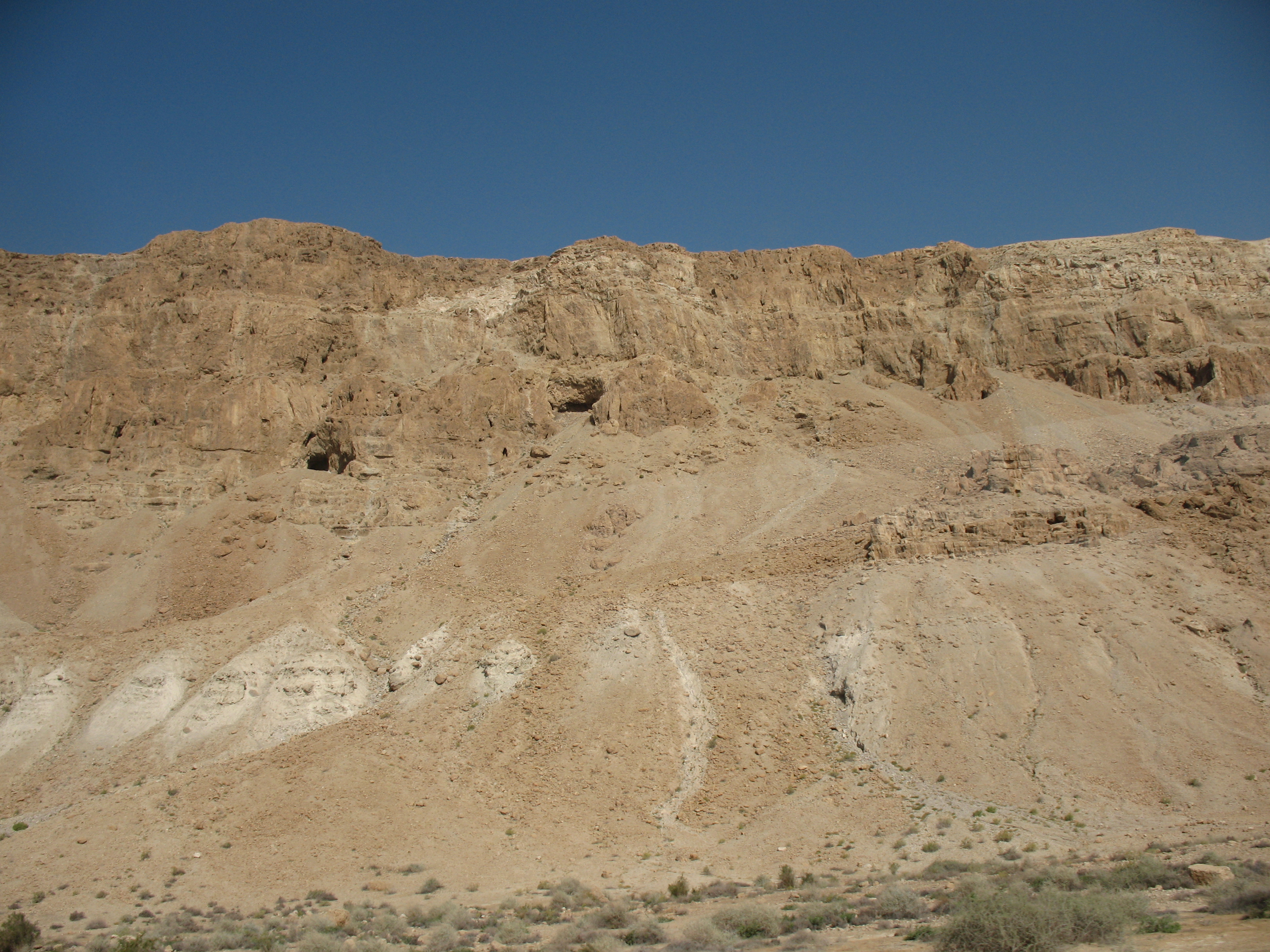
אזור ים המלח - מבט ממסלול נחל אוג Photo: James Emery from Douglasville, United States, CC BY 2.0
Data sources
The information on this page was collected from these sources.
- ropes.community
- parks.org.ilרשות הטבע והגנים (Israel Nature and Parks Authority), License: Israeli government (INPA) public information, facts only
- wikidata.orgLicense: CC BY-SA 4.0 (text), CC0 (Wikidata)
- openstreetmap.org© OpenStreetMap contributors, License: ODbL 1.0
Comments on this site
General comments on the whole site. About one part? Use "Comments" next to its heading.
No comments here yet.